Fact-checked by the VisualEnews editorial team
Quick Answer
LiDAR sensor technology uses pulsed laser light to measure distances and build precise 3D maps of the surrounding environment. As of July 2025, LiDAR is deployed in autonomous vehicles, robotics, and smartphones, with the global market projected to reach $9.6 billion by 2032, growing at a CAGR of 24.5%.
LiDAR sensor technology — short for Light Detection and Ranging — works by emitting rapid laser pulses and measuring the time it takes for each pulse to return after bouncing off an object. That time-of-flight calculation produces precise distance data, which software assembles into a detailed three-dimensional point cloud. According to MarketsandMarkets’ LiDAR market analysis, the global LiDAR industry was valued at approximately $2.3 billion in 2023 and is scaling rapidly across multiple sectors.
The technology has moved well beyond aerospace and military surveying. In 2025, LiDAR chips are embedded in consumer smartphones, factory robots, and self-driving prototypes — making it one of the most consequential sensing technologies of the decade.
How Does LiDAR Sensor Technology Actually Work?
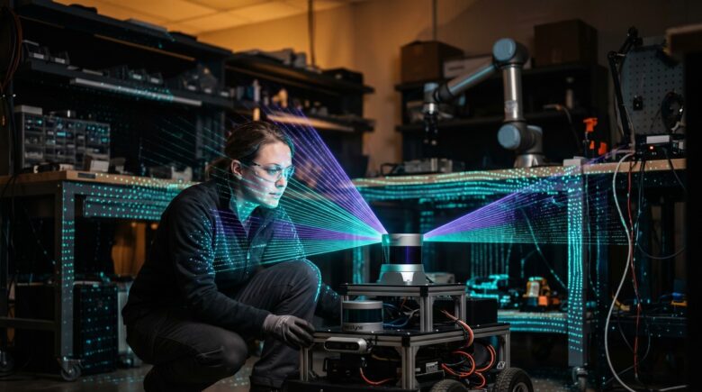
LiDAR fires laser pulses — typically in the near-infrared spectrum — and times exactly how long each pulse takes to return to the sensor. That elapsed time, multiplied by the speed of light and divided by two, yields a precise distance measurement. Repeat this millions of times per second, and you build a dense point cloud that represents the physical world in three dimensions.
Most LiDAR systems consist of three core components: a laser source, a photodetector, and a timing circuit. The laser emits light at wavelengths around 905 nm or 1,550 nm, with 1,550 nm systems offering longer range and greater eye safety. The photodetector captures returning photons, and the timing circuit — often accurate to within a few nanoseconds — converts flight time into distance.
Mechanical vs. Solid-State LiDAR
Early LiDAR units used spinning mechanical assemblies to sweep lasers across a wide field of view. Companies like Velodyne Lidar popularized this approach for autonomous vehicles. Solid-state LiDAR, pioneered by firms such as Luminar Technologies and Innoviz Technologies, replaces moving parts with fixed arrays or micro-electromechanical systems (MEMS), dramatically reducing cost and improving durability. IEEE Spectrum’s LiDAR coverage documents how solid-state designs are now the dominant direction for mass-market adoption.
Key Takeaway: LiDAR works by timing laser pulses traveling at the speed of light, generating millions of data points per second. Solid-state designs from companies like Luminar Technologies are replacing spinning units, cutting hardware costs by up to 90% compared to early mechanical systems.
Where Is LiDAR Sensor Technology Used Today?
LiDAR sensor technology appears across a surprisingly wide range of industries in 2025 — from the roof of a robotaxi to the back of a flagship smartphone. Its core value is always the same: centimeter-accurate spatial awareness that cameras and radar alone cannot provide.
In autonomous vehicles, Waymo and Cruise integrate LiDAR as the primary spatial sensing layer, using it to detect pedestrians, cyclists, and road obstacles at distances exceeding 200 meters. In consumer electronics, Apple embedded a LiDAR scanner in the iPhone 12 Pro in 2020 and has continued the feature across its Pro lineup, enabling faster augmented reality performance and improved low-light photography. Just as wearable technology is reshaping personal health sensing, LiDAR is reshaping spatial computing at a consumer scale.
Industrial and Geospatial Applications
Aerial LiDAR mounted on drones or aircraft allows surveyors to map dense forest canopies, archaeological sites, and flood plains at resolutions impossible with satellite imagery alone. The United States Geological Survey (USGS) operates the 3D Elevation Program (3DEP), a national effort to collect high-quality LiDAR data across the entire country, covering terrain mapping and natural hazard modeling. Agricultural firms also use drone-mounted LiDAR to assess crop height and biomass with sub-centimeter precision.
Key Takeaway: LiDAR is deployed in autonomous vehicles, smartphones, drones, and national mapping programs. The USGS 3D Elevation Program uses LiDAR to map the entire U.S. terrain, with point density targets of 2 points per square meter for standard-quality coverage.
| Application | Key Player | Range / Accuracy |
|---|---|---|
| Autonomous Vehicles | Waymo, Luminar | Up to 250 m, ±2 cm |
| Consumer Smartphones | Apple (iPhone Pro) | Up to 5 m, ±1 cm |
| Aerial Surveying | USGS (3DEP Program) | Up to 6,000 m AGL, ±10 cm |
| Industrial Robotics | SICK AG, Ouster | Up to 120 m, ±3 cm |
| Augmented Reality | Apple, Microsoft HoloLens | Up to 5 m, ±0.5 cm |
How Does LiDAR Compare to Radar and Cameras?
LiDAR sensor technology occupies a distinct niche between radar and cameras: it delivers the geometric precision of a camera without relying on visible light, and the range and weather tolerance of radar without sacrificing resolution. Each sensor type has trade-offs that define where it fits in a sensing stack.
Cameras produce rich color and texture data but struggle with depth estimation and perform poorly in low light or glare. Radar excels in rain, fog, and darkness, detecting metal objects at long range, but its angular resolution is coarse — it can tell you something is there, not exactly what shape it is. LiDAR fills the gap: it produces structured 3D geometry regardless of lighting, though heavy rain and snow can scatter laser pulses and reduce effective range.
Tesla famously pursued a camera-only approach, arguing that human drivers navigate with vision alone. Most competitors, including Waymo and Mobileye, maintain that sensor fusion — combining LiDAR, radar, and cameras — produces the redundancy required for safe Level 4 autonomy. This debate shapes billions in R&D spending annually. Understanding how sensor fusion fits into broader computing architectures is easier if you first understand what edge computing is and how it works, since LiDAR data is increasingly processed at the edge rather than in the cloud.
“LiDAR gives autonomous systems a precise geometric understanding of the world that neither cameras nor radar can replicate alone. The question is no longer whether LiDAR belongs in the stack — it’s how to make it cheap enough for every vehicle on the road.”
Key Takeaway: LiDAR outperforms cameras on depth accuracy and beats radar on spatial resolution. According to Mobileye’s sensor fusion research, combining LiDAR with radar and cameras reduces object-detection errors by more than 40% compared to any single-sensor approach.
What Are the Cost Trends Shaping LiDAR Sensor Technology?
Cost has historically been LiDAR’s biggest barrier. Early Velodyne units used in autonomous vehicle prototypes around 2007 carried price tags above $75,000. By 2025, mass-market solid-state LiDAR modules from companies like Hesai Technology and RoboSense are available for under $500, with automotive-grade units targeting sub-$200 price points at scale.
This cost compression mirrors patterns seen in other semiconductor-driven technologies. The same economic forces that drove down the price of GPS modules and MEMS accelerometers are now working on LiDAR. Grand View Research’s LiDAR industry report attributes much of the cost decline to MEMS fabrication advances and the shift to photonic integrated circuits (PICs), which allow laser arrays to be etched onto silicon wafers at scale.
The trajectory is relevant beyond autonomous vehicles. Affordable LiDAR is enabling an entirely new generation of spatial computing devices, smart building sensors, and precision agriculture tools. The broader technology convergence underway mirrors trends discussed in our overview of how quantum computing will change everyday technology — foundational sensing and processing advances compounding simultaneously.
Key Takeaway: LiDAR unit costs have dropped from over $75,000 in 2007 to under $500 in 2025 for solid-state modules. Grand View Research projects continued price erosion driven by photonic integrated circuit manufacturing at wafer scale.
What Does the Future of LiDAR Sensor Technology Look Like?
LiDAR sensor technology is converging with artificial intelligence, 5G connectivity, and edge computing to create sensing systems that do far more than measure distance. Next-generation systems will classify objects in real time — distinguishing a child from a shopping cart, or a cyclist from a stationary post — directly within the sensor hardware itself.
Several emerging developments will define the next five years. 4D LiDAR — which adds velocity as a fourth data dimension alongside X, Y, and Z coordinates — is already shipping from companies like Aeva Technologies, using frequency-modulated continuous-wave (FMCW) laser techniques. This allows a sensor to know not just where an object is, but how fast it is moving and in which direction, without needing a separate radar unit.
Regulatory frameworks are also maturing. The National Highway Traffic Safety Administration (NHTSA) and the European Union Agency for Cybersecurity (ENISA) are both developing standards for sensor reliability in safety-critical autonomous systems. Those standards will shape which LiDAR architectures gain regulatory approval for commercial deployment. For context on how connectivity infrastructure supports these systems, see our breakdown of 5G vs. Wi-Fi 7 and which wireless technology fits different use cases.
Key Takeaway: 4D FMCW LiDAR from companies like Aeva Technologies adds real-time velocity measurement, while NHTSA’s automated vehicle safety frameworks are setting the standards that will determine which sensor architectures reach mass-market vehicles by 2027.
Frequently Asked Questions
What is LiDAR sensor technology in simple terms?
LiDAR is a sensing technology that fires rapid laser pulses and measures how long each takes to return, converting that data into a precise 3D map. Think of it as sonar, but using light instead of sound. It is accurate to within a few centimeters across distances of hundreds of meters.
Is LiDAR the same as radar?
No. Radar uses radio waves and excels in adverse weather but has low spatial resolution. LiDAR uses laser light and produces far more detailed 3D point clouds, but can be affected by heavy rain or fog. Most advanced autonomous systems use both together for redundancy.
Does my iPhone have a LiDAR sensor?
Yes, if you own an iPhone 12 Pro or any later iPhone Pro model, it includes a LiDAR scanner on the rear camera array. Apple uses it to accelerate augmented reality app performance, improve autofocus in low light, and enable depth-based photography effects.
How accurate is LiDAR sensor technology?
Accuracy depends on the system design and range. Consumer-grade LiDAR in smartphones achieves roughly ±1 cm at distances up to 5 meters. Automotive-grade systems achieve ±2–5 cm at ranges up to 250 meters. Aerial survey-grade systems typically achieve ±10 cm at altitudes up to 6,000 meters above ground level.
Why is LiDAR so expensive for autonomous vehicles?
Early mechanical LiDAR required precision-machined spinning assemblies, driving costs above $75,000 per unit. The shift to solid-state designs using MEMS mirrors and photonic integrated circuits is reducing that cost dramatically. Automotive-grade solid-state units are approaching the $200 price point needed for mass vehicle integration.
What is a LiDAR point cloud?
A point cloud is the raw output of a LiDAR scan: a dense collection of data points, each representing a surface location in 3D space with X, Y, and Z coordinates. Processing software converts these millions of points into recognizable objects — roads, walls, people, vehicles — using algorithms and, increasingly, AI-based classification models.
Sources
- MarketsandMarkets — LiDAR Market Size, Share and Global Forecast
- United States Geological Survey — 3D Elevation Program (3DEP)
- IEEE Spectrum — LiDAR Technology Overview
- Grand View Research — LiDAR Industry Analysis and Market Report
- National Highway Traffic Safety Administration — Automated Vehicles for Safety
- Luminar Technologies — Automotive LiDAR Products and Research
- Mobileye — Sensor Fusion and Autonomous Driving Technology