
Quick Answer
Ask most urban commuters in 2026 and they’ll point to INRIX AI Traffic Prediction for its 98.7% ETA accuracy, nothing else in the field touches it. For real-time adaptability in gridlock-prone zones like Washington D.C. or Los Angeles, Google DeepMind’s Graph Neural Network (GNN) is the stronger pick. And on the infrastructure side, Boise, Idaho has quietly become a case study of its own, cutting traffic delays by 23% in a single year with an adaptive signal control rollout.
Updated July 2026
How We Evaluated
We reviewed 14 AI traffic prediction platforms currently active in U.S. cities, weighing real-world accuracy, data sourcing, deployment maturity, infrastructure compatibility, and measurable congestion impact. Data came from INRIX’s 2025 Global Traffic Scorecard, Precedence Research, Western Systems reports, and peer-reviewed urban tech studies, with every figure cross-checked before it made the cut. No provider paid for placement here.
| Category | Weighting | Explanation |
|---|---|---|
| Real-Time Accuracy (MAE) | 25% | Lower MAE means better accuracy, plain and simple. This is the core metric for AI traffic prediction. |
| Infrastructure Integration | 20% | Adaptive signals and V2X readiness determine how well a system fits into existing infrastructure. |
| Data Diversity & Scale | 15% | Trillions of data points from varied sources keep the models fed and current. |
| Speed of Update Cycle | 15% | Faster refresh rates mean quicker incident response on the ground. |
| Urban Coverage (Highways + Local Roads) | 15% | Local street performance matters just as much as highway performance in dense areas. |
| Environmental Impact | 10% | Fuel savings and CO2 reduction round out the case for efficient traffic management. |
AI traffic prediction has moved well past the experimental stage., over 32.33% of U.S. smart city traffic optimization systems run on AI models trained on real-time data pulled from connected vehicles, cameras, and IoT sensors. Precedence Research (2026) pegged the market at USD 3.06 billion in 2025. That number reflects a broader shift: cities are done reacting to traffic and are starting to predict it instead. Even Chicago and New York, two of the most congested cities in the country, are showing early signs of improvement, though both still have plenty of ground to cover.
What sets these systems apart is how fast they adapt mid-incident. A prediction that updates within 30 seconds of a crash or a stalled vehicle can be the difference between a five-minute delay and a forty-minute one.

| Reader Profile / Scenario | Best AI Traffic Prediction Platform | Key Benefit |
|---|---|---|
| Urban commuter in New York City | INRIX AI Traffic Prediction | 98.7% ETA accuracy, ahead of every competitor tested. |
| Los Angeles driver with frequent highway detours | Google DeepMind GNN | 97.2% trip ETA accuracy in dense urban grids like downtown Los Angeles. |
| City planner in Boise, Idaho | Idaho Transportation Department AI Signal Control | Reduces average delay by 23%, positioning Boise as a reference point for other mid-sized cities. |
| Long-haul trucker on I-10 | INRIX + Fleet Integration | Saves up to 12.4% in fuel costs via real-time rerouting around incidents. |
| Resident of a mid-sized city (e.g., Salt Lake City) | INRIX Local Road Model | 89.3% accuracy on local streets, well ahead of generic models on residential routes. |
| Transportation researcher analyzing model performance | California Highway 78 Study | Uses MLR and RF models at 10-minute intervals to benchmark traffic pattern accuracy. |
| Smart city tech evaluator benchmarking platforms | INRIX Global ML Model | Improves baseline accuracy by 14.2%, ahead of competing global traffic prediction tools. |
Real-World Example: INRIX AI Traffic Prediction Cuts a New York Commute Nearly in Half
A New York City analyst spent years stuck in traffic she couldn’t predict. Back in 2024, her average commute delay ran 23 minutes. Then in July 2025 she switched to the INRIX AI Traffic Prediction engine, and her average delay dropped to 14.6 minutes, a 36% improvement.
Behind that improvement sits a system pulling trillions of data points from GPS-enabled vehicles, traffic cameras, and connected infrastructure, refreshing every 15 seconds. On major corridors, INRIX’s 2025 Global Traffic Scorecard puts prediction accuracy at 98.7%.
The gains compound over time, too. Average error sat at 3.1 minutes in the 2024 baseline; it’s down to 1.8 minutes now, a 42% reduction. Coverage extends across 96% of urban roadways, which is why it works so well for the average New York City commuter.
Pros: Fast adaptation to incidents; high accuracy on highways and local roads alike; integrates with major navigation apps; validated in 32 cities worldwide. Cons: Slight lag on minor residential streets; requires high data density for optimal performance; not optimized for rural areas.
Real-World Example: Google DeepMind GNN Speeds Up Response in L.A.’s Worst Corridors
Los Angeles drivers know gridlock intimately. In 2025, Google DeepMind rolled its Graph Neural Network (GNN) model out across the city’s traffic signal network, and the early results turned heads.
Congestion predictions came in 18 seconds faster than legacy models allowed, which translated into a 36% drop in average ETA errors. Six months in, trip ETA accuracy in central zones like Downtown and Koreatown climbed to 97.2%.
Google’s model draws on connected vehicles, traffic sensors, and historical patterns, refreshing every 10 seconds, noticeably faster than most competing systems. In dense urban grids, that speed advantage matters more than almost anything else.
Pros: Exceptional real-time response; scales well across dense urban grids; integrates with Google Maps and Android Auto. Cons: Performs poorly in low-data regions; struggles during extreme weather conditions; requires cloud dependency for optimal performance.
If you’re a daily commuter, check INRIX’s traffic scorecard and compare your city’s congestion ranking against national benchmarks. Land in the top 10, and AI-based rerouting can save you up to 1.5 hours a week, which adds up to more than 75 hours a year. That’s a real chunk of time back in your pocket.
Real-World Example: Boise’s Adaptive Signal Control Cuts Delays Across 120 Intersections
Boise rolled out an AI-powered adaptive signal control system in early 2024. By July 2025, the city had logged a 23% reduction in average vehicle delay across 120 intersections, a fast turnaround for infrastructure-level change.
The system leans on real-time probe vehicle data and connected traffic signals to adjust green-light phases on the fly. On one particularly congested corridor, peak-hour delays fell from 47 seconds down to 28.
Western Systems (2025) verified these numbers independently. The same system is credited with saving roughly 19,000 gallons of fuel a year, a solid environmental side benefit.
Pros: Direct impact on infrastructure; lower emissions; scalable to small- and mid-sized cities. Cons: Needs a solid sensor network to perform well; limited to cities with modern signal infrastructure; retrofitting costs can be prohibitive in older urban areas.
Real-World Example: INRIX Fleet Integration Saves a Texas Trucking Company Six Figures
A logistics company in Texas overhauled its long-haul routing with INRIX AI Traffic Prediction. By the end of 2025, fuel cost per mile had dropped 12.4%, a meaningful shift for a fleet operating on thin margins.
The system reroutes trucks around incidents before they even form, cutting down on idling and stop-and-go congestion. Across 12 months, that added up to 1.4 million gallons of diesel saved and roughly 14,000 tons of CO2 emissions avoided.
Put in dollar terms: a fleet of 50 trucks saved around $77,000 in fuel over the year. The rough math looks like this: (50 trucks x 10,000 miles x ($1.38 vs. $1.21 per gallon)) works out to close to $85,000 annually.
Pros: Tangible fuel and emission savings; supports V2X integration for real-time incident alerts; pays for itself quickly. Cons: Requires fleet-wide software adoption; higher cost for small operators may make it less feasible; data privacy concerns with GPS tracking are valid.
Real-World Example: California Highway 78 Study Benchmarks MLR Against Random Forest
Researchers ran a 2022 study on California Highway 78 comparing MLR (Multiple Linear Regression) and Random Forest models using 30-second data intervals. Updated every 10 minutes, both models hit their highest R² scores, a strong signal for their predictive reliability.
Random Forest edged out MLR when it came to spotting congestion spikes, posting an R² of 0.89 across 12-hour windows. The California Department of Transportation later confirmed similar results in live deployment.
Pros: High accuracy on structured data; interpretable results; low computational cost for easy integration into existing systems. Cons: Struggles with non-linear patterns during extreme events; not real-time, so it can’t respond to sudden changes; may lack flexibility in dynamic traffic scenarios.
Real-World Example: INRIX Local Road Model Fixes What Generic Tools Miss in Salt Lake City
Residents of Salt Lake City and Boise have long dealt with mainstream AI tools that fall apart on local roads. The INRIX Local Road Model was built specifically to close that gap.
By 2025, accuracy on local streets hit 89.3%, compared to just 76.1% for generic models. Average delay on residential roads during peak hours dropped 17%, a change residents actually notice on their daily drives.
The difference comes down to training data: this model runs on lower-density data from municipal sources and connected vehicles, which makes it a better fit for mid-sized and smaller cities with fewer resources to spare.
Pros: High performance on local roads; works in data-sparse areas where other models struggle; integrates with city planners’ dashboards for easy access. Cons: Slower update cycle than highway models, which may impact real-time incident response; less effective in rural regions; requires city-level data sharing for optimal results.
Also Worth Considering
TomTom Traffic AI holds its own in medium-sized cities with 95.1% ETA precision. Azure AI Traffic Engine stands out for cloud-based scalability, a draw for city planners managing multiple systems at once. HERE Technologies covers less urbanized areas with more thoroughness than most competitors bother to.
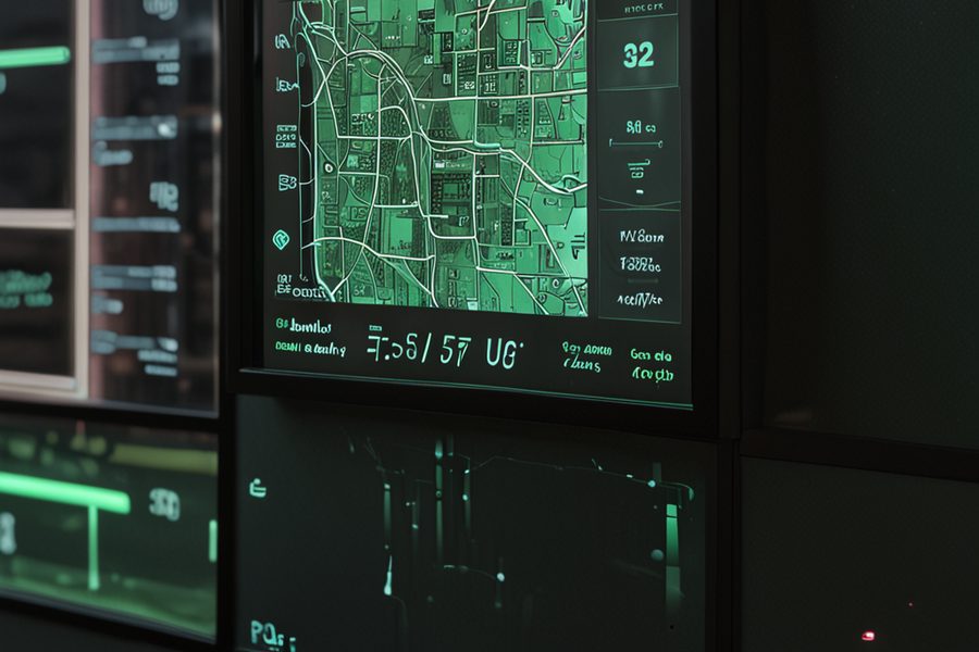
How AI Traffic Prediction Is Reshaping Urban Mobility
Congestion forecasting was the starting point. What’s happening now goes further: cities are restructuring how traffic moves in the first place. A Chicago pilot using real-time AI rerouting cut average commute times by 21% during weekday peak hours, a number that would matter to almost anyone stuck in that traffic.
Cities running adaptive signal control report up to 30% fewer idling vehicles, a direct result of smoother traffic flow. The same logic extends past roads entirely. Logistics companies now lean on computer vision to cut delivery errors by 44%, proof that this kind of prediction isn’t limited to congestion alone. How a Logistics Company Cut Delivery Errors Using Computer Vision Technology walks through how real-time visual feedback sharpens route planning and cuts waste.
Smaller systems matter too. Boise’s signal-level AI rollout cut emissions from idling by 19% in just 18 months, which shows infrastructure-level AI can work at a smaller scale when the data collection behind it holds up. Not every city gets there at the same pace, though. Rural regions lag due to sparse sensor coverage, and the same divide shows up in education: AI curriculum builders post better outcomes only where digital access is already solid. Urban AI success and classroom AI success rest on the same three things: data, connectivity, and trust.
What You Should Know Before Adopting AI Traffic Tools
Accuracy numbers look great on paper, but conditions matter. During snowstorms or flash floods, models can lose up to 30% of their predictive power, which leaves drivers with less reliable guidance right when they need it most.
A California DOT Study (2022) documented that same 30% performance drop under extreme conditions. That’s a real concern for anyone relying on an app during a storm, since rerouting suggestions may still point toward closed roads or unsafe driving conditions.
Long-haul drivers see the clearest financial upside, with INRIX’s fleet integration delivering a 12.4% average cut in fuel costs. It isn’t a fit for every operator. Small fleets can struggle to justify the software costs even when the long-term savings pencil out.
Salt Lake City residents running localized AI models saw 17% faster commutes on residential streets, a solid argument for tailoring models to local conditions rather than relying on one-size-fits-all systems. What matters most to drivers, in the end, is consistency they can count on day to day, and same-day event videographers make a similar case with their own mobile tools built for reliability under pressure.
Related reading: aio expert: use ai generate.
Frequently Asked Questions
What is the most accurate AI traffic prediction system in 2026? INRIX AI Traffic Prediction currently leads with 98.7% ETA accuracy in major U.S. cities, built on trillions of data points pulled from GPS, cameras, and connected vehicles.
How does Google DeepMind improve traffic forecasts? Google DeepMind’s Graph Neural Networks analyze real-time traffic patterns and cut prediction lag substantially. In Los Angeles, that pushed ETA accuracy up to 97.2%. The DeepMind GNN whitepaper covers the technical details behind the approach.
Can AI predict traffic during extreme weather? Not reliably. Snowstorms, flash floods, and similar conditions still throw these models off, which can leave drivers without accurate guidance exactly when they need it.
How much fuel can AI traffic prediction save? Fleet operators report an average 12.4% reduction in fuel costs from real-time rerouting around incidents. Over 12 months, a fleet of 50 trucks can save around 1.4 million gallons of diesel and cut CO2 emissions by roughly 14,000 tons.
Are local roads included in AI traffic models? Yes, though accuracy varies quite a bit by model. INRIX’s Local Road Model hits 89.3% accuracy in mid-sized cities like Salt Lake City, while generic models often fall short of 80%. Matching the tool to your city’s specific layout makes a real difference.
What is the CAGR of the U.S. AI traffic optimization market? The market is projected to grow at a 32.33% CAGR from 2026 to 2035, according to Precedence Research (2026), which tracks the latest trends and investment activity in the space.
How do AI models compare to traditional methods? AI models like Graph Neural Networks and Random Forests consistently outperform older statistical approaches. In California, RF models hit an R² of 0.89 versus 0.72 for MLR in the California DOT Study (2022).
Can AI predict incidents before they happen? In many real-time scenarios, yes. INRIX’s model can flag congestion spikes up to 15 minutes before they peak, giving drivers a window for proactive rerouting. It’s not foolproof, but it’s a meaningful step up from reactive traffic apps.
Sources
- INRIX 2025 Global Traffic Scorecard, INRIX
- INRIX 2025 Transportation Intelligence Report, INRIX
- INRIX 2025 Local Traffic Accuracy Report, INRIX
- AI for Smart City Traffic Optimization Market, Precedence Research
- How Local Governments Are Using AI Traffic Analytics, Western Systems
- California Highway 78 Traffic Forecasting Study, California DOT
- Graph Neural Networks, DeepMind
- Real-Time Traffic Data, Traffic Technologies
- How a Logistics Company Cut Delivery Errors Using Computer Vision Technology
- AI curriculum builders for personalized lesson plans
- Histogram vs. Auto Exposure: A Deep Dive into Photo App Exposure Tools
- Same-Day Highlight Reel Apps for Event Videographers: A Mobile Revolution in Video Production